Click
image to see PDF file.
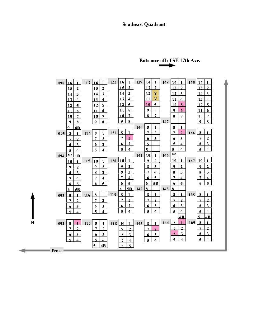
New
Cemetery Plot Maps (Search all plot and
grave locations)
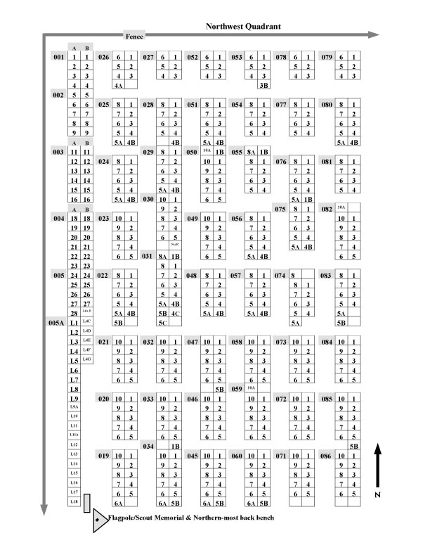
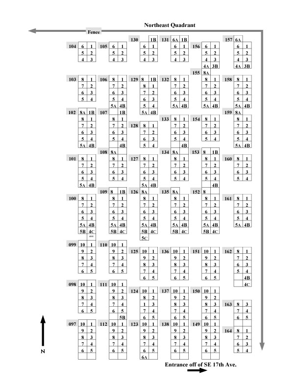
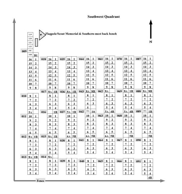
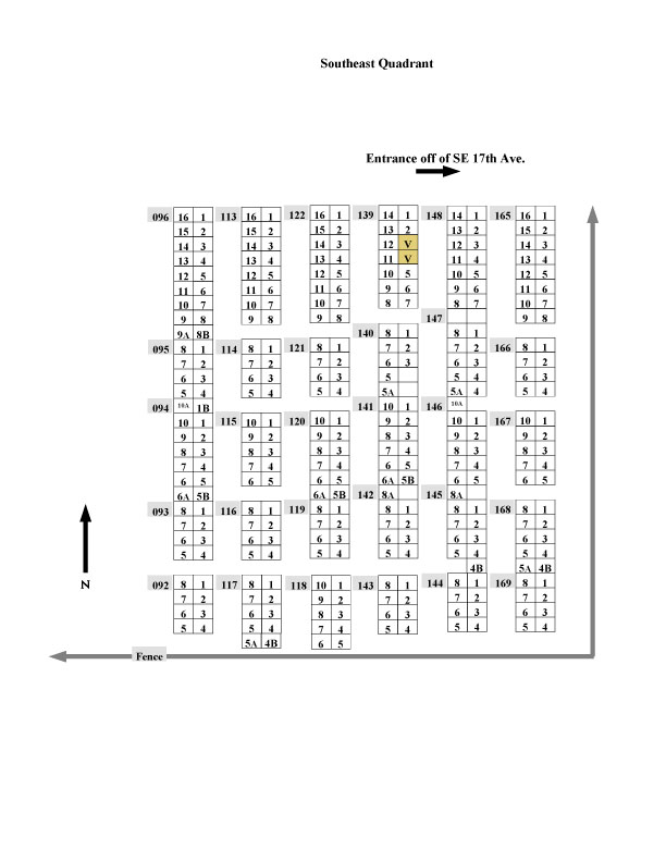
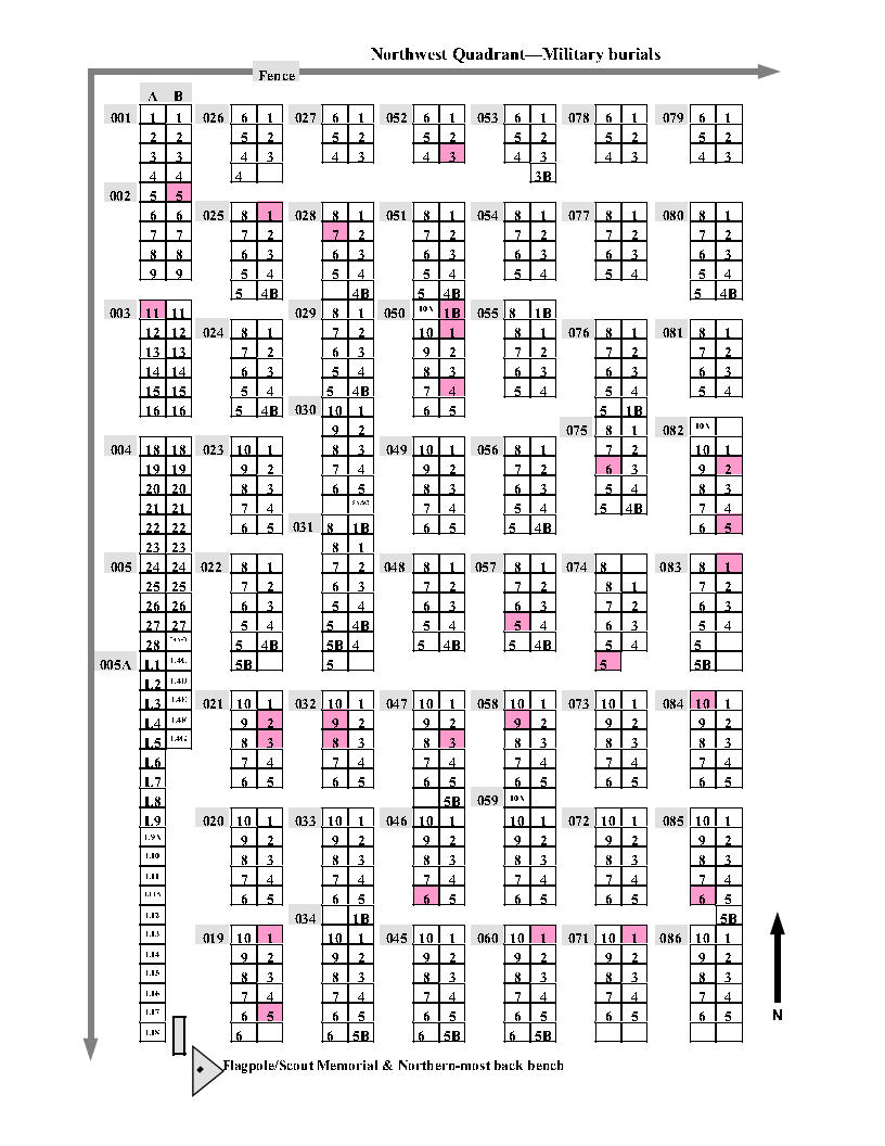
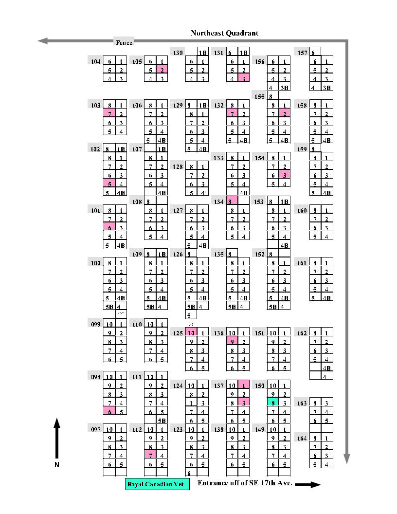
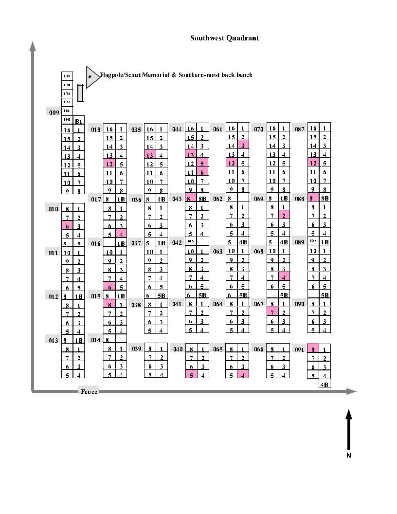
These maps were set up from a hand-drawn map
from the 1970's which gave a fairly good approximation of the Plot and Grave
locations. We do not know how the 1970's map was put together, but we do know
there was no actual scale used and some areas, graves and plots could
be larger or smaller than they appear on the map. Some markers may also have
been moved, but at least this gives you a starting point...
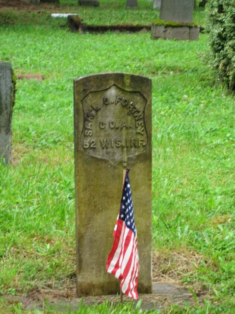
The numbering system was used before the turn
of the century, and even though it's confusing, we decided to retain it because
all existing records are tied to it.
For the least stressful use of the maps, keep
in mind that the Plot numbers start in the NW corner and run South and North
in a zig-zag pattern from West to East, which is why each quadrant map ends at
the central walkway and the numbers continue on across the walkway. This
means you may need to consult more than one map. There may have been two sources
from long ago as the NW Grave numbers were set up differently
than the balance of the Cemetery. Unfortunately we do not have records back far
enough to tell us how this may have come about.
Should you have additional questions, don't
hesitate to contact us.